- Home
- About NZDFI
- Our Science
- For Growers
- For Wood Users
- Library
- Contact

- Home
- About NZDFI
- Our Science
- For Growers
- For Wood Users
- Library
- Contact
INDIVIDUAL TREE BIOMASS ESTIMATION USING UAV LiDAR
As part of our Marlborough Regional Forestry and Biomass SLMACC project, researchers from the University of Canterbury explored the potential of UAV-mounted LiDAR to measure individual tree components and estimate biomass.
The objectives were:
- Estimate individual tree biomass from UAV-LiDAR metrics (E. bosistoana and E. globoidea)
- Compare different machine-learning models with the statistical model developed as part of the SLMACC project
- Evaluate how useful UAV-LiDAR metrics are for estimating of stem dimensions and biomass.
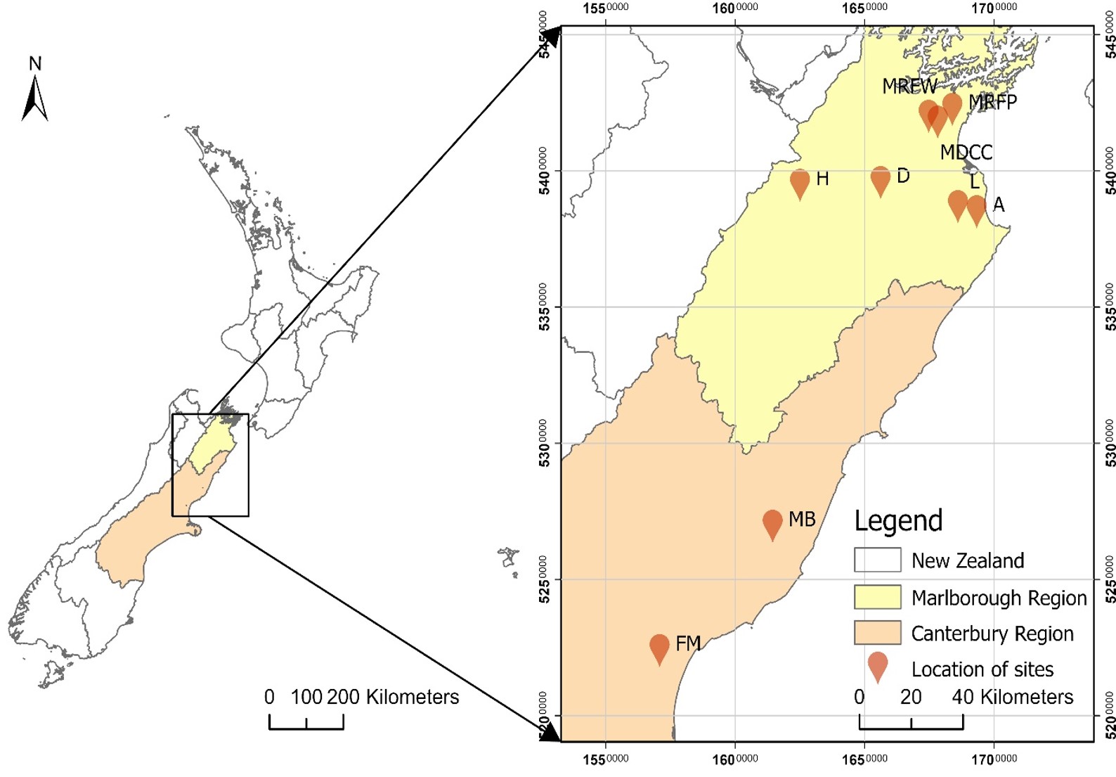
Project survey sites
Nine sites in North Canterbury and Marlborough were surveyed with the UAV, before trees were destructively sampled by the summer student crew working on the project. This physical sampling provided ground-truthing data which could be used later to verify the LiDAR data.
The LiDAR data collected is interpreted as a point cloud, with a point density in this case of over 500 points per square metre.
Following point cloud processing, tree metrics such as canopy height, tree height and crown size can be extracted. Point clouds of individual trees can be produced.
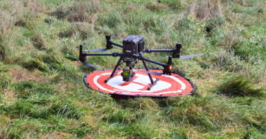
UAV with LiDAR camera used for site surveys.
Individual tree segmentation

Canopy height model

Individual tree segments

Individual tree point cloud
Challenges in interpreting the data, including e.g. crown overlap, were dealt with by using other sources of data such as aerial photos and measurements made by the field crew.
The research team then used four different models to assess the data describing individual tree height, DBH and biomass. This was to identify which model performed best in terms of producing results closest to the ground-truthed data.
In summary, the researchers showed that UAV-LiDAR produced precise biomass estimation, with the 'PLSR' model emerging as a standout performer.
The research was presented by Dr Ning Ye at a NZDFI workshop in Blenheim on February 16th 2024.
The presentation is available here.